
The Southern Coast

Image via Trip Advisor
HVERAGERÐI
The geothermal town of Hveragerði is just 40 minutes south east of Reykjavík. It is situated in the Reykjadalur Valley and is home to around 2,300 residents. Here you can find amenities such as gas stations, grocery stores, hotels, a camp ground, restaurants, hiking trails, and museums. High geothermal activity lies beneath the town, even allowing for bananas to be grown here.
Maybe the most popular hiking trail in town leads to the Reykjadalur Hot Springs, where after approximately an hour of walking, you’re rewarded with the toasty waters of underground hot springs. The hike is not a technical one, and the elevation is gradual. When you reach the bathing location, there are wooden bridges and steps, and changing screens but not rooms. So, you’re still pretty exposed when changing.

VÍK Í MÝRDAL
There are a few things that Vík is known for- its black sand beaches, picturesque red-roofed church, and paragliding. This small town on the Southern Coast of Iceland is 2.5 hours from Reykjavík.
The church, Reyniskirkja, sits upon a hill overlooking the town. Depending on which way you observe it from, it can be backed by glaciers or the black sand beaches. If the Katla volcano were to erupt, the higher-ground that the church sits on would be the place of refuge to stay safe from a flash-flood induced by the lava melting the Mýrdalsjökull glacier.
The Víkurfjara black sand beach probably won’t be like the beaches back home that you’re used to, but it’ll likely be quiet and prove a relaxing stop to be immersed in the Icelandic nature.
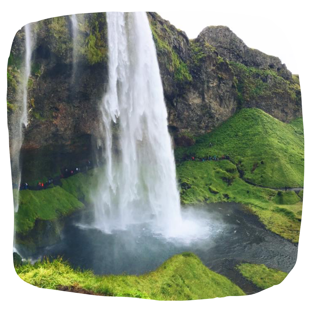
SELJALANDSFOSS and GLJÚFRABÚI
Seljalandfoss is often one of the waterfalls that people imagine when they think of Iceland. It drops an impressive 200 feet, and a walking path allows you to walk all the way around the falling water. The thunderous flow does create a lot of mist, so be prepared to get wet and step over slippery rocks.
Just pass Seljalandfoss, the Gljúfrabúi waterfall is hidden behind rocks- where you’ll walk through a crack in the rock, and a shallow stream, before reaching the hidden falls. You’ll be surrounded by mossy, cavernous walls with an open sky. And while it is along the same road as Seljalandfoss, many tourists do not realize it is here and never get to enjoy it.

SKÓGAFOSS
Another one of Iceland’s most popular waterfalls, Skógafoss is along the Skógá River and was once the coastline, making the waterfall a former sea cliff. Like Seljalandfoss, it falls 200 feet and also creates a considerable amount of spray. While you can’t encircle these falls, you can hike above the falls thanks to a 527 step staircase on the nightside. I highly recommend hiking above the falls if you are able to- whether that be to complete the Fimmvörðuháls trail or just walk a mile or so along the river.
Another fun activity here is camping- there is a campground (large field) where you can pitch your tent or camper van with quite an impressive view.
VATNAJÖKULL NATIONAL PARK
Vatnajökull National Park covers a whopping 11% of the country and is one of three national parks in Iceland. The terrain in the park varies, with volcanoes, mountains, canyons, waterfalls, and wetlands making up the landscape.

JÖKULSÁRLÓN and DIAMOND BEACH
The Jökulsárlón Lagoon on Iceland’s south coast is a glacial lagoon with bold blue waters and icebergs floating amongst the water. (If you’re lucky, you’ll also get to see harbor seals here as well), You can walk around the lagoon on your own, or you can join a boat tour (Zodiacs or Amphibian Boat), or an ice cave tour. A difference between the Zodiacs and Amphibian Boat tours, are that the Zodiacs can cover a wider range of the lagoon and get closer to the icebergs.
The river flowing out through Diamond Beach is that of the lagoon, and it is here you’ll find icebergs from the lagoon washed up on shore. The contrast of the black sand and the sparkling icebergs give the beach its name.